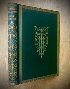
January is a good month for fireside travelers. Written around 1864, Fireside Travels is a collection of essays by the American writer James Lowell in which he shares his experiences of his hometown of Cambridge, Massachusetts and his travels around Italy.
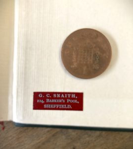
A 1909 green and gilt edition of Fireside Travels currently sits on a stand in our bookshop. Its cover caught my eye with its elegant Art Nouveu design of golden intertwining stems set into dark green cloth. The book’s title was intriguing, but something of even greater interest was to be found on the inside back cover, (the ‘rear pastedown’ in booksellers’ language). Tucked into the bottom left corner is a tiny magenta label with G. C. SNAITH, 124 BARKER’S POOL, SHEFFIELD printed in silver. This sparked my curiosity – I wanted to find out about this Sheffield bookshop from over a century ago.
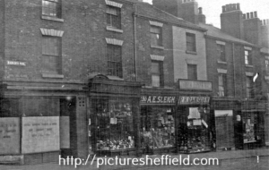
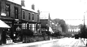
George Collinson Snaith was a bookseller in Barker’s Pool, specifically, “Pool Square”, in the late Victorian and early Edwardian periods. The Picture Sheffield image below shows a row of shops in Pool Square, all of which were demolished in the 1920s to make way for the City Hall.
 www.picturesheffield.com: image Reference s13277
The left edge of the picture shows the corner with Holly Street and Division Street, probably more or less the location of today’s Women of Steel sculpture. Below the BARKER’S POOL street sign is Robert Cross’ butchers shop, its blinds lowered. Moving right, at number 132, are the Misses J. A. and M.E. Peirson, florists, while A. E. Sleigh Ltd., surgical instrument makers, can be seen at number 130. Next is hatter Robert Ramsden. A hoarding for “ZEPHYR ZEPHYR HATS” sits above Ramsden’s sign. In 1899, Ramsden was advertising his “ZEPHYR ZEPHYR” silk hats and “fine felt hats” in local newspapers with slogans such as “Light as a Feather”, “Black as a Sloe” and “Latest London Styles”. At number 126 are the Misses Mayor, needlework dealers, and then there’s Snaith’s bookshop just visible to the very right: there seem to be books and papers displayed against the windowpanes.
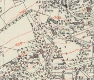
The little label had led from our bookshop in Endcliffe to an Edwardian bookshop in the town centre. But what about the owner – did he live above his premises or was his home elsewhere? It turned out that George Snaith lived out of town in Fulwood’s emerging suburbs. At the time of the 1901 and 1911 censuses, (the period in which the photograph above was most likely taken), George was married and living on Nethergreen Road.
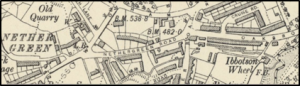 Revised: 1902 to 1903, Published: 1906 Reproduced with permission of The National Library of Scotland
From this point in George’s life, it is worth travelling back along his timeline to see what we can learn about his earlier days. Born in 1857 and the oldest of six children, George came from the Darlington area where his father William was an accountant for the railway. The famous Stockton to Darlington line was the first to use steam locomotives for passenger transport and is viewed as the beginning of our modern railway. Coincidentally, the line opened the year of William’s birth in 1825. Perhaps this gave him an affinity with the railway from an early age. Whether he felt a special connection with the S&DR or not, his white-collar profession would place him in a relatively comfortable social class. That the family employed a servant was another indicator of the Snaith’s social standing.
By the time he was 24 in 1881, George had moved down to Sheffield and was employed as stationer’s assistant, lodging at Gloucester Street in Broomhall. George’s mother Mary was born in Hatfield, near Doncaster, so perhaps this was the connection which led him to south Yorkshire.
Stationery and books have a natural connection and by 1887 George had established his bookshop in Barker’s Pool. A local newspaper advertisement from that year directed readers to Snaith’s Booksellers if they liked the sound of a new publication called “THE CONFESSIONS OF A BACHELOR; and other Sketches” by H. Grafton (“Decidedly amusing…will promote laughter wherever read”). At some point in 1909, when our copy of Fireside Travels was published, it must have made its way into Snaith’s shop and perhaps one of his apprentices, (for which he advertised vacancies), stuck that tiny label inside the back cover.
Newspaper advertisements show that Snaith’s was not only a shop to buy the latest good reads, but also a place where you could buy tickets for events. For example, in February 1904 you could catch “Little Lord Fauntleroy by Mrs Frances Hodgson Burnett” performed at The Albert Hall. In November 1910, you could pop into Snaith’s to buy a ticket to hear the pioneering folk music and dance collector Cecil Sharp give a “Morris and Country Dancing Lecture…with Twelve illustrative Dances”. This event took place at the Temperance Hall and was hosted by the Sheffield Branch of The Teachers Guild.
Although there appears to be no record of George in the 1891 census, it is on record that he married Alice Robinson in the summer of that year. Alice’s family had moved to Sheffield from Buckinghamshire. Her father Edward was a commercial traveller, selling leather goods. At the time of her marriage to George, Alice’s family were living in Sunnybank, in Broomhall. This was the period when George was lodging in Broomhall which suggests there was a local factor in their meeting.
This takes us back to Nether Green, where the couple settled. Snaith’s Booksellers is listed in the 1911 White’s Directory for Sheffield, but George died in March of the following year, aged only 55, sadly providing a sudden end to a journey which began with a bookseller’s label.
Jane Bartholomew, January 2026
 Reproduced with the permission of the National Library of Scotland
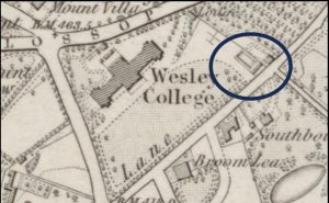 Reproduced with the permission of the National Library of Scotland
 Lord’s Seat – see AC’s Substack article:
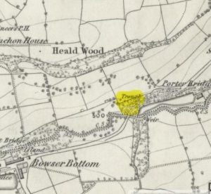
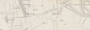 1854: Lumley Lodge is to the right of the map. Reproduced with the permission of the National Library of Scotland
 Glossop Road, Broomfield Road, Stumperlowe Hall Road, and a variation of the design in Mount View, Glossop Road