These arial pictures were taken by the RAF about 1948. The aircraft was flying south so the Hallamshire Golf Course is at the bottom of the original picture and the reference number is at the top left.
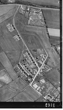
For ease, I have rotated the photographs so that the Golf Course which is north of the Hallam Grange Road is at the top of these images. In describing these photographs, I am using their orientation as shown, rather than in the originals
Barncliffe Crescent
Just left of centre is Crimicar Lane with the Isolation Hospital on itsright side. across the photo rising towards the right hand side is Redmires Road. The road than stops abruptly at a field boundary is Barncliffe Road with Barncliffe Crescent curving away behind the hospital. The projection of the Crescent to join Hallam Grange Road is evident from both ends
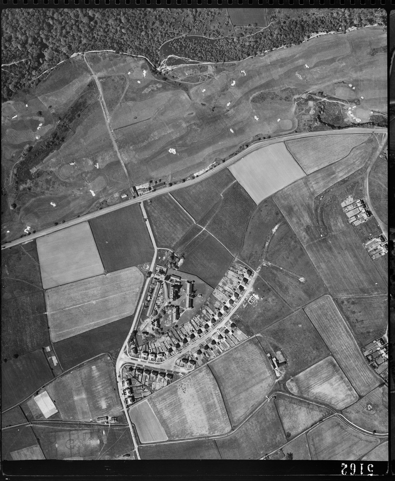
Hallam Grange Road
On the left edge of the second photo in the midle is the curve of the top of Hallam Grange Road with the outline of the Crescent just visible.. The conduit is across the lower part of the photo. Slayleigh Lnae is still narrow. At its junction with Hallam Grange Crescent is the Hallam Grange Tennis Club.
Along Redmires Road are three large houses, from left to right they are No 85, ‘Trednock’ and the Ridge. Only No.85 remains as The Ridge became an estate of houses and an block of flats in the 1960s or 1970s while Trednock was demolished about two years ago and a block of apartments with a few houses behind buily on the site.
Hallam Grange Estate from the air
The Hallam Grange Estate was begun in the late 1920s but interupted by WW2. The order of building suggests that different builders were involved.
Some of the footpaths visible in these photos still exist
I am looking for photos of Barncliffe, a house opposite the Hallamshire Golf Club and Course on Redmires Road.
The house may have been photographed at the time of the 1948 aerial survey.
With many thanks
Richard
Please could you tell me if the club house is shown on these aerial photos? I am looking for photos of Barncliffe, a house at 17 Redmires Road, Sandygate, which was standing between 1871 and about 2008 when it was demolished by the Council. With many thanks for any information you can give me.
Hi Richard
Unfortunately Barncliffe is to the east (right) of these pictures.
I did not note where I found these pictures on the WWW and have been unable to locate them again.
Keith